
Earth 3D Map
Category:Map navigationSize:61.0MVersion:v2.3.2.5Time:2024-09-09 09:21
- Introduction
- Related applications
- User Reviews(0)
Welcome to Earth 3D Map - an application that provides high-definition 3D views of the Earth. Using the latest satellite imagery, Earth 3D Map allows you to browse any place on Earth in detail, from surface terrain to forests, rivers, lakes, buildings, and roads. With this powerful tool, you can experience global travel on your phone without leaving your home.

【2024】3D earth HD map,world street view,satellite imagery
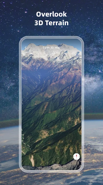
High definition 3D Earth view:
Immersive experience: Provides high-resolution 3D views of the Earth, helping users clearly see details of the Earth's surface.
Map slice data loading:
Dynamic update: Supports loading map slice data to ensure users receive the latest geographic information and detailed data.
Compass function:
Navigation Assistance: Built in compass function, helping users accurately determine direction and location while browsing maps.
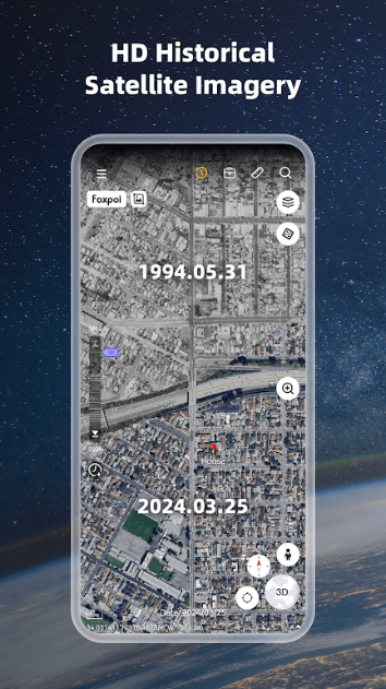
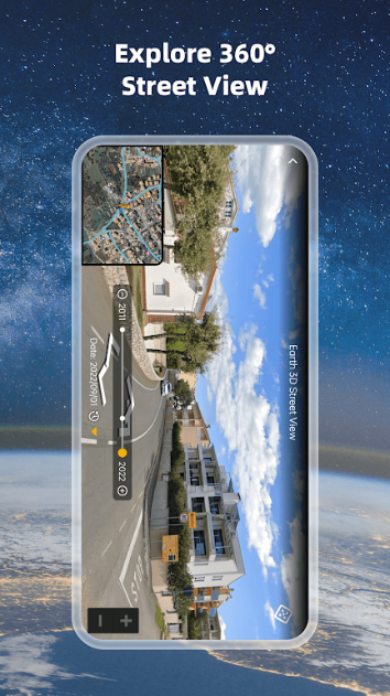
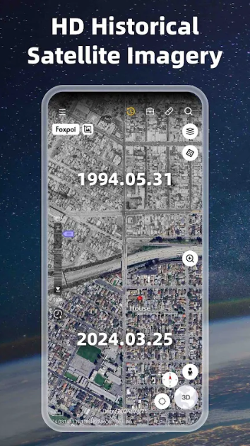
View historical street scenes:
Time reversal: allows users to view historical street scenes and understand the past appearance of a certain location.
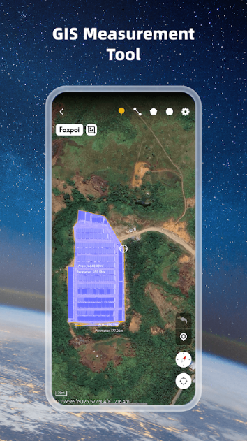
Regional distance measurement:
Accurate distance measurement: Provides measurement tools to help users accurately calculate the distance between any two points on the Earth's surface.
Latest satellite imagery:
Instant update: Provide the latest satellite imagery to ensure users can view the latest information on the Earth's surface.
World map and satellite map:
Dual view selection: Supports two view modes, world map and satellite map, to meet the needs of different users.

Software advantages
High definition and detail:
Fine display: Provides high-resolution 3D views and the latest satellite images, which can display various details of the Earth's surface in detail.
Convenient navigation function:
Compass support: Built in compass function to help users better locate and navigate on the map.
Combining historical and modern perspectives:
Time travel: Combining historical street scenes with the latest satellite imagery, allowing users to compare changes in the Earth's surface at different times.
Practical measuring tools:
Accurate distance measurement: a regional distance measurement tool suitable for various scenarios that require ground distance calculation.

Software Highlights
Immersive 3D Earth View:
Real experience: Through high-definition 3D views, users can obtain a near real experience of the Earth's surface, as if they were in person.
Latest satellite imagery:
Dynamic update: Utilizing the latest satellite images to provide users with the most accurate geographic information and the latest Earth surface conditions.
Historical Street View Function:
Comparison between past and present: Through the historical street view viewing function, users can explore the appearance of the Earth in the past and compare it with the current situation.
Comprehensive map view:
Multi view selection: Supports dual view switching between world maps and satellite maps, making it convenient for users to choose the appropriate view mode according to their needs.
Official website:None
Package name:com.think.earth
Name:Earth 3D Map
MD5:43d1f942653f445d52b919a1fe5a30e9


You Might Also Like
Recommended

chaton ai mod apk
39.8MDownload
Blood Pressure Tracker mod
40.1MDownload
Balance mod apk (Subscribed Unlocked)
63.6MDownload
wallhaven 4k wallpapers for Android
8.7MDownload
wps office mod premium 2024
119.0MDownload
VSCO Unlocked Pack
86.7MDownload
nox cleaner mod apk 2024
47.8MDownload
screenshot pro - auto trimming mod apk
6.7MDownload